Hartley
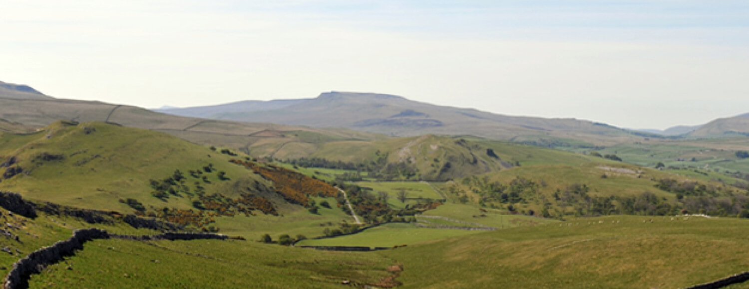
The lands of the Foundation at Hartley extend to some 338.12 hectares, stretching from the banks of the River Eden to the limestone ridge of Longrigg Scar, 413 metres above sea level. Some of the low-lying land has been converted to wetland by the excavation of pools and scrapes, surrounded by areas of wet meadow and rush pasture. Hedges have been restored and new woodlands of native species planted. Hay meadows are being managed in ways that will increase the abundance of wild flowers. On the higher ground, there are areas of flower-rich limestone grassland and patches of limestone pavement, cliff and heath. Curlews and Black Grouse are among the upland birds.
The slopes are also archaeologically important, with several Bronze Age burial mounds and the remains of a series of Iron Age and Romano-British farm settlements.
Most of the land at Hartley lies within the North Pennines Area of Outstanding Natural Beauty, and four areas within it have been designated as County Wildlife Sites. The upper ground is also Access Land under the Countryside and Rights of Way Act, and the summit of Longrigg Scar commands a superb view across the Eden Valley to the Lake District and the Cross Fell Pennines.
Access
The high ground of Longrigg Scar, with the adjacent Fell Lane and the allotments of High Longrigg and Low Longrigg are Access Land, and the public have a right to roam there. However, these areas are also County Wildlife Sites and are grazed by livestock, so people are asked to behave responsibly and to keep all dogs on a lead.
There are no public rights of way over the greater part of the remainder of the estate, the exception being the footpath and ancient corpse road between Kirkby Stephen (Frank’s Bridge) and Coffin Bridge on the Kirkby-Hartley road. However, the Trustees have established a concessionary path from Hartley via the track up the field known as Outgang and along the disused railway line to the road from Winton to Cote Garth farm. From here you can walk back to Winton along a marked public footpath or turn south along Fell Lane to the open moor of Winton Common and the Access Land on Longrigg Scar. The Trustees have issued a guide to these walks, which is available from the Tourist Information Centre in Kirkby Stephen.
The low-lying meadows nearest to Hartley and Kirkby Stephen, and especially the wetland areas, are not open to the public. A number of the fields are managed as hay meadows, and all the fields are grazed by cattle and sheep. Visits to part of this area can however be arranged on application to the Foundation’s agent, and in the future, the Trustees hope to develop facilities for visitors, including school parties, similar to those at Hay Bridge.
CODE OF CONDUCT FOR VISITORS
- Unless on Access Land, keep to the public footpaths.
- Park vehicles only at designated car parks or where they will not cause an obstruction or block the view of other road users. NEVER drive off-road.
- Keep dogs on a lead at all times and if with a dog, do not walk near cattle. Cows with calves and ewes with lambs should especially be avoided.
- Clean up after your dog and take waste to a bin.
- If taking photographs, please keep a respectful distance from birds and mammals. Nest boxes should not be approached closer than 10 metres, otherwise there is a risk that the birds will desert eggs or young.
- If picnicking, take all your litter home and NEVER light fires.